Thursday, September 30, 2010

Glaciers, Bears & Wildfires, Oh My

Our plan upon leaving the Yukon was to head down the Stewart-Cassiar Highway. There are some interesting things to see along here, plus then I wouldn't have to drive the same stretch of the Alaska Highway again. So we turned off the Alaska Highway, somewhat thrilled to be leaving the land of frost heaves, only to be stopped at a roadblock because of a wildfire that was burning pretty much right along the Cassiar. We had arrived 5 minutes late and would have to wait for the next pilot car. So we did, and it was quite an experience to be piloted through a basically active wildfire area. We couldn't stop, for obvious safety reasons, so our only pictures are kinda blurry due to the motion of the car. It is definitely eerie to see a forest like this:


But I saw forests in Yellowstone only 5 years after fire, and it is definitely true that they grow back quickly. Hopefully that will happen here as well.

One the main reasons to take the Cassiar Highway is that it provides many, many opportunities to see black bear, as you can see:


This momma and her cubs were my favorite, but we didn't get much time to observe them because this big old truck came barreling down the road honking his horn and scaring them off.

Another reason to take the Cassiar is that it also enables you to visit what is probably one of the most isolated towns in the US: Hyder, AK. It is only accessible by road through the slightly more populated Stewart, BC and is so far removed from the rest of the US that it uses Pacific time (instead of Alaskan) and Canadian schools money. (You still have to go through customs, though). The main attraction here is the Fish Creek Viewing Platform run by the US Forest Service. This area is officially part of Tongass National Forest.


Everyone goes and stands on that platform and then the bears come and catch salmon in the creek. We didn't see any bears in the creek (bummer) but we did see tons of salmon doing their spawning thing.


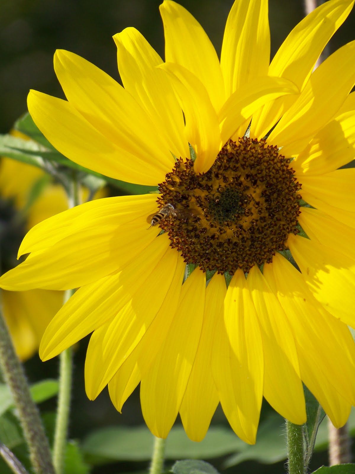
We also got our first good look at the temperate rain forest, which produces massive trees that you find pretty much halfway down the Pacific Coats. They are just so beautiful and majestic.


Another thing you can do here, which is according to Lonely Planet USA is "totally worth the trip," is drive to Salmon Glacier, which is purportedly the largest glacier in the world accessible by road. The forest service ranger assured us that it was a lovely, hour-long drive. Now, I had already known the road was about 17 miles long. You think I would have put those two pieces of information together and realized something was amiss, but no, I just accepted the road guide she handed me and off we went on our merry way. The first views along the drive were beautiful.


Um, until I looked down and happened to notice just how high above the valley we'd gotten.


And these people clearly have a different definition of "maintained road" than I, because my idea of maintenance involves more than one lane, seal coat (at a minimum) and guard rails. But it was too late to turn around, so we soldiered.....er, snailed?....on.


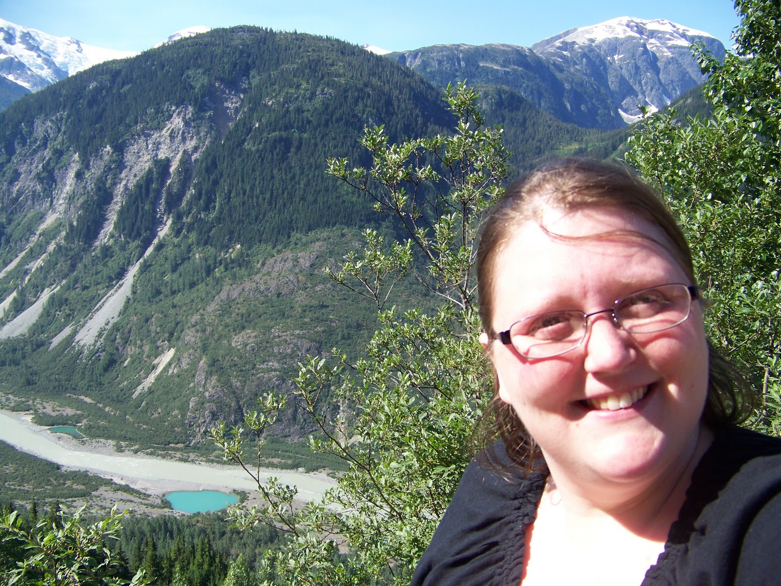
It was probably one of the scariest things I have ever done, but it was kind of one of those no-turning-back-now moments (especially since I'm lucky to do K turns when there are four lanes and the worst that can happen is you bump someone's mailbox). The view at the top, though incredibly buggy, was so worth it. I guess the Lonely Planet writers weren't just being cliche after all.


Coming next, the rest of our stay (in way more populated) southern BC, including the gorgeous Minter Gardens & Vancouver.

Sunday, September 26, 2010

Yukon Gold

The drive from the Alaskan border to Haines Junction involves some of the most beautiful scenery combined with some of the most horrific road conditions. A long day and a half in the Yukon, but still totally worth it.


A trumpeter swan in a pond just over the Canadian border. Apparently, swans like the cold, because there are five species common to this area.


Burwash Landing is located along the shores of Kluane Lake, which is absolutely beautiful. The area was developed because of the Yukon gold rush, as you can see by the "world's largest" gold pan sign. We may not have struck it rich in gold, but if eye-popping scenic views could be traded for case, I would not be working anymore!


Kluane Lake. It is so beautiful along here that you just want to sit and enjoy the view forever.


Kluane Lake is located in Canada's Kluane National Park & Reserve. This area, along with Wrangell-St. Elias National Park in the US, are home to many of North America's highest peaks, including Mt. Logan, which straddles the US-Canadian border; the area is designated a UNESCO World Heritage site. I've seen several of those in my travels now, and if you're near one, stop and check it out. It's always worth it.


The mountains overlooking Kluane Lake. I think these are called the Pelly Range. Or maybe the Ruby Range, but basically they are an extension of the northern Cascades.


Miles Canyon, where the Yukon River narrows just upstream from Whitehorse. Again it's amazing how clean and beautiful the water looks.


The suspension bridge over Miles Canyon. It was pretty scary and wobbly, but I'm proud to report that I made it across. Almost makes me want to go back and try the Hell's Gate bridge again. Almost.


The views on the other side of the bridge were so worth walking over it. We went on a (short) hike until the sun started to sink in the sky. Which of course was a beautiful sight itself.


There's just something about pine trees that makes my heart happy. Not that I don't like other kinds of trees, but that northern, scrubby pine, clear water, crisp air landscape is so peaceful. We liked Miles Canyon so much that we decided to stay in Whitehorse for the night. We did so at Robert Service Campground, a tent-only campground that was one of the best we stayed in. Unfortunately, we didn't take any pictures.


After we pitched our tent, we went exploring around Whitehorse a bit, taking in the sunset over the Yukon. And making a much-needed Wal-Mart stot, where we were surprised to find pretty good prices for the middle of nowhere Canada.

The next morning we continued down the Alaska Highway, stopping briefly in Teslin to check out the Teslin Tlingit Native Heritage Center, which was a "must-stop" for me. Of all the native art and culture I experienced (which actually wasn't much, although it wasn't nothing, either), I think the Tlingit culture is my favorite, so I was excited to see how the inland groups lived compared to their coastal cousins. (Although I still haven't been to Sitka and some of the other coastal regions where the Tlingit live).


These are some Tlingit totems. I love the colors and the style of the animal representations.

Well, that concludes our brief time in the Yukon. The Yukon Visitor's Center in Whitehorse has an amazing video about other places to go, and someday I'd like to see Dawson City and drive the Dempster Highway to Inuviak.

Up next will be our exploits in British Columbia, including driving through an active wildfire, seeing dozens of black bears, driving to the top of a glacier, and enjoying Vancouver's Stanley Park.


Tuesday, September 21, 2010

Leaving Alaska

Despite what an awesome (albeit slightly indirect) trip home I had, it was really hard to leave Alaska. It was great that Tasha was with me for so many reasons, but those first few days, her presence definitely prevented me from turning around and going back to Wasilla. Saying good-bye to my dad (and Susanne) was pretty hard. Witness my red, teary face!


Anyway, once we got going, it wasn't so bad. And I obviously came home, so that was good (although how long I'll stay is anyone's guess). Our first few days were mostly a lot of driving. The scenery along the Alaska Highway is beautiful, but those frost heaves are killer. That first day, we only made it to the Alaska-Yukon border, because we left late (of course!), go stuck in construction, stopped at Fred Meyers (always good for an hour or so), and visited a few places, too.


A big polar bear (the only kind of bear I have yet to see in the wild-but Churchill, Manitoba is so on my list) at the Santa Claus house in North Pole.


Another shot for my collection of "the biggest ______ in the world" things. This one is a vintage Santa, proudly displayed in North Pole.


The Trans-Alaska Pipeline suspension bridge over the river....I think it's the Tanana, but I saw so many rivers I kinda lost track.


Rika's Roadhouse, which was (and still is, in a way) a stop along the old dogsled route from Fairbanks to Valdez.


A sunflower from the garden at Rika's. Check out the bee in the center of the flower, doing his pollination thing.


The other end of the Alaska Highway. I officially drove the entire thing-without getting a flat tire or eaten by a bear.


Gorgeous mountains (I believe they're the Wrangell-St. Elias range) along the Alaska Highway south of Tok.


The international boundary between the US and Canada. Apparently they clear the trees and brush along the boundary once every ten years-sounds like a fun job!!

Up next, the rest of our (mis)adventures in the Yukon!

Sunday, September 19, 2010

Wildlife in the Wild

Without further ado, here are the best shots of the wildlife we saw on our Denali bus trip. Some of them are not of great quality, because while my camera's nice, it's not that nice. But it was absolutely amazing to see all these animals behaving as if we weren't even there. Truly the experience of a life time.

A female moose, sort of in the center of the picture. Not the most exciting shot, but this was the first wildlife we saw on the shuttle bus trip.

A pica, which looks like a mouse but is actually the smallest member of the rabbit family.

For some reason, I was having trouble getting the cropped image to upload. But if you look in the middle of the picture, you'll see some black specks, one right near the tree line and another laying down slightly below and to the left. Those are part of a wolf pack we saw. I will work on getting the cropped images up.

A big grizzly bear we spent about ten minutes watching. He was sort of just ambling along, chomping on bushes and berries. Our driver said it was probably a juvenile, and you can kinda see the radio collar around his neck.

A whole bunch of Dall sheep, just chilling, on the cliffs below Polychrome pass. There were about nine of them in all.
A mama moose and her calf, running across the hillside. That little guy was soooooo cute.

A lone wolf running for cover.

You can just make out the caribou standing along the ridge line. We actually saw tons of caribou, but some of those pictures were ones I also had trouble cropping. I also have a few of some big bull moose. If I'm able to solve the problem, I'll post when I can.

Up next, I'll be starting to show you my journey home, which if you followed my live blogging, you know took some, er, interesting turns. Also, I'll be at the National Book Festival in DC next weekend-always one of my favorite trips, and, as long as I get the hotels squared away, I'll be in Vermont on Columbus Day weekend with my grandma. 

Wednesday, September 15, 2010

The Great One

The Denali bus ride was definitely one (of the many) highlights of my time in Alaska. I have so many pictures from the park that it would be impossible to share them in just one post, if only because it takes my slow computer forever to load them. So I'll start today with some shots of the mountain itself, from all different places in the park.

Because Denali is such a high mountain, it makes its own weather and is often all clouded in. In fact, only 30% of park visitors usually get to see the peak clearly. This July, it was visible only one day from the Eielson Visitor's Center. So we were incredibly lucky to have some great views of it for two days in a row!

This was my first view, from along the Parks Highway near Nenana.

An even better view from another spot along the Parks Highway. Isn't amazing how, despite the fact that there are mountains all around you, Denali just dominates the sky?

This may have been my favorite view. I took this from Savage Campground at about 6 am. The way the clouds were, and the spruce trees, against the clear, stark white of the peaks, it was this breathtaking sight. The photos I took don't even come close to doing justice to the beauty of the acutal scene.

I love this shot for the juxtaposition of the colors. You can see the green plains in front of you, leading up to the rocky mountains, which are dominated by the snow-covered peaks of Denali itself.

I totally forget where this is, but it's not far from Eielson. Our bus driver told us this was a pretty iconic shot, with the road in the foreground. You can see that by this point, around 11 am, the mountain was already starting to cloud over.

The view from Eielson, with no zoom, from about 35 miles as the crow flies from the mountain.

This shot has some zoom, and I love again how it shows the different elevations.

A close-up of the summit.

That's me :-). I was a little frustrated because I was taking shots for everyone around me, most of which came out really nice, and this is the best of the ones people took for me. It was windy and of course it's hard to photograph a white mountain against a light sky, but still, I was disappointed. However, that didn't last long, because I was mostly overjoyed to have seen such natural beauty.

Up next (by this weekend), my Denali wildlife shots. I will warn you now, most of them are grainy and blurry, but you can still tell what kind of animal it was. So stay tuned!!!