Saturday, December 1, 2012

Time Flies

I cannot believe how long it's been since my last post. I have so much to update. I'm going to finish the recap of my 2011 trip, and then I have several smaller trips to add. I'm also gearing up for an amazing 2013 summer trip  to hit the rest of the northern national parks I haven't visited. Here's hoping that our impending plunge over the fiscal cliff doesn't result in a tax increase that ruins my plans.

I'm also using this post to test out my new tablet, which will be journeying with me this summer encased in an otterbox to prevent the unfortunate screen damage mishap of 2010.

Thursday, August 9, 2012

Moab, Utah in Pictures

Moab, located on the Colorado River as it cuts across the Colorado Plateau in southeastern Utah, has been the setting for over fifty movies and television programs, including Indiana Jones and the Last Crusade, Thelma and Louise, and Con Air. As you turn off I-70 to head south towards the town, it's easy to see why. Brilliant red rocks glisten everywhere you look.


I stayed at the Moab KOA, which was pretty nice except for the bathrooms. (I've noticed that if a campground has mixed-gender single bathrooms, they're usually disgusting, which was the problem at this KOA). The town itself is cute, with a few main streets of shops and restaurants-my favs were the Moab Brewery and La Hacienda. It also has an amazing public library with WiFi that is a great place to beat the mid-afternoon heat.

But the big draw in Moab is the outdoors. Two national parks, Arches and Canyonlands, are basically right in Moab, as is easy access to the Colorado and tons of mountain biking trails. I stuck to hiking and photography, but I'd like to go back one day to get out on the river and also to go off-roading in Canyonlands.


It's hard to choose a favorite: both of these parks have amazing views and cool rock formations. (Both are also definitely in the desert and require proper hydration). At Canyonlands' Island in the Sky District, the visitor center is small but has some informative exhibits. I also got the chance to hear a really great ranger program about the geology of the area. I headed into Arches later in the afternoon in order to get some shots of the rocks during the evening golden hour. Here are several of my favorite:

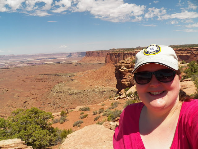
Canyonlands: These shots are all from overlooks near the VC and along the Grand View Point road.


Arches: So gorgeous. I literally drove around with my jaw dropping.

Park Avenue:


Balancing Rock:

Delicate Arch: A flash flood washed out the road to the Delicate Arch viewpoint just before I arrived in the park, stranding dozens of people until the waters receded late that night. A very helpful ranger told me where I could find an old-fashioned can-on-a-stick aimed at the arch. The shots aren't the best, but at least I was able to see. I also met a really nice British couple and was able to share the secret.


Double Arch: A short trail leads right up underneath the arches (some people were even climbing on them). The desert is surprisingly fragile; a biological soil crusts forms every where there aren't green plants. This crusts helps retain water and prevent erosion and is so fragile that it can take anywhere from 20 to 250 years for the crust to recover if it is crushed by a careless footfall. (Soapbox moment: It breaks my heart when I see people disregarding warning signs about environmental issues like this. It may seem fun at the time to venture off trail, but if everyone did it, soon the desert will be irrevocably altered). 


Amazing well-preserved petroglyphs near the Delicate Arch trail head:

The Delicate Arch Trail: I didn't have enough water or a flashlight with me to attempt this, but it's definitely on my list for a return trip to Moab:

Fiery Furnace:

Skyline Arch:

Best. Sunset. Ever.


Monday, July 23, 2012

The Light at the End of the Scary Road (Glenwood Canyon)

The Colorado River begins like most rivers, a trickle high up on a mountain pass, in this case La Poudre Pass in the Front Range of the Rockies. It descends some 10,000 feet as it races down the Colorado Plateau, seeking, as all good rivers do, the path of least resistance to sea level. (Too bad it doesn't actually reach the sea anymore, but that's a topic for a different post).


The Colorado River in its infancy, a mild-mannered little stream


It is possible to leave the western entrance of Rocky Mountain National Park and follow the course of the Colorado River all the way to Moab, Utah, just west of where the Colorado converges with the Green River on its journey towards the famed Grand Canyon. (Unless you're me, of course, and you get a little off-course for a while. But eventually you're forced back to the river to head west out of the Rockies and into the high, dry inter-mountain region.) 


But to do that, you have to go through the canyons cut by the river, with the river. Suspended over it, in fact, through Glenwood Canyon (click the link for pics, because I was too scared to stop and take any). There are over 40 bridges and tunnels and other crazy feats of engineering that make is possible for humans to drive this route, but if you're not expecting it (which of course I wasn't), I-70 in western Colorado can be a scary thing. At one point, you can clearly see that you're going west, somewhere below you are the eastbound lanes, and below that is the train, everything cantilevered above above the surface of the river. 


If I were in charge, I would have just gone around the mountains a different way. It was the creepiest feeling ever to be at the bottom of this towering canyon (which may not have been all that towering, but was definitely the deepest canyon I've ever been at the bottom of) with the river, which at least seemed raging, right there. No recourse if there was an emergency situation-earthquake, fire, random wildlife herd stampeding across the road-unless you were prepared to climb straight up the mountain. 


But like many situations in life, once you've passed through them and survived, you start to think to yourself, Hey, maybe I could do that again. And this time, since I know I won't be swallowed whole by towering canyon walls, chewed up and spit back out into the mighty river, maybe I could stop along the way and enjoy the scenery. Because for all its scariness, Glenwood Canyon is also spectacular, especially to a sea-level-dweller like me. 


The best part of all is that after you leave Glenwood and squeeze through De Beque  Canyon, you head out onto a flat plateau with mountains rising in the distance all around you, the river now your cherished friend. Driving west through this country at the sunset golden hour was breath-taking.

Heading towards the mesas of Arches & Canyonlands country, just off of I-70


Until I realized that I'd better hurry the heck up and get to civilization-which in these parts is limited to Moab, Utah-before scary, nocturnal desert things started crawling around the road. But that's a story for tomorrow...


Rocky Mountain National Park (or An Ode to Mountains)


I love mountains. When I was a kid, I thought I lived near some nice mountains. Then I went to Europe in college and stayed at a hotel on the summit of Mt. Pilatus in the Swiss Alps. Those were Mountains compared to what I had grown up with. But it wasn't until I drove through the Big Horn Mountains on my first cross-country trip that I really found out what mountains were. And now I am addicted to them. So Rocky Mountain National Park was a much-anticipated stop, which did not disappoint.


See? Mountains everywhere you look. It's like God took two-thirds of Colorado and crumpled it up like a piece of copy paper and then tried to smooth it back out again, only you can't really smooth paper back out; thus, the many ranges and peaks of the Colorado Rockies were formed.


Mountains so tall that nothing grows on top of them. Mountains that are, well, rocky.


And mountains that are covered with snow. Even in July.


Bear Lake was probably my favorite place in the park. I went later in the day, finishing up my short hike around the lake just before sunset, so it wasn't too crowded. The altitude kicked my butt a little, even though I had just slept at 8,000 feet in Yellowstone a few days before. I just love how the blues were so blue and the greens were so green, especially against the stark gray of the mountains. And how the mountains stand so proudly and resolutely above the rest of the world, like sentinels watching over humanity and nature.

RMNP also has some cool wildlife. Here's a Stellar's jay, which is so brilliantly blue and beautiful.


I also saw a TON of elk. At the top of Trail Ridge Road, which runs over the mountains at a top elevation of around 12,000 feet, I saw about ten bull elk grazing in a field.


This guy was my favorite, even though he wouldn't pick his head up for me.


Up at the Alpine Visitor Center on Trail Ridge Road, a huge herd of mamas and babies congregated.


On the other side of the mountains, I saw several moose grazing along the banks of the teeny, tiny Colorado River, more like a stream at this early stage of its journey.


Another thing I was really looking forward to was seeing tons of wildflowers. I didn't see tons, but the ones I did encounter embodied everything I love about wildflowers; they were sweet, colorful, delicate yet hardy, bringing a mini-party to the harsh mountaintop.


I definitely plan to return to RMNP one day, hopefully earlier in the season so I can see even more flowers. And one day I'd like to come in the fall to hear the elk bugling. It's really a beautiful place.


Where Has All The Time Gone?

So this summer is half over, and I was meant to be updating this blog with my 2011 travels. So I'm going to start doing that, at least one post per day, before my ever-aging brain forgets what happened!

Thursday, June 7, 2012

Tentative plan for a three-week road trip this summer. It's ambitious, I know, but I just can't handle the thought of not seeing the Pacific Ocean!


Thoughts?

Wednesday, June 6, 2012

Grand Teton National Park

Located in Wyoming in between Yellowstone National Park and the town of Jackson, WY, Grand Teton National Park is truly stunning. The park is linked to Yellowstone by the John D. Rockefeller, Jr. Memorial Parkway. As you head south out of Yellowstone to drop into the Snake River valley, you are treated to glimpses of the jagged Teton peaks.


The road then turns and begins to follow Jackson Lake, providing views of the Tetons in profile. I don't think any picture can truly do justice to the majesty of these mountains, which tower over Jackson Hole with (Hole being the early settlers' word for valley) with elevations ranging from 11,000 to 13,000 feet.


Another stunning view of the Tetons:


The view of Mt. Moran from the Oxbow Bend overlook, with the mountain reflected in the Snake River.


This is the view from Signal Mountain. If you visit the Tetons (which you should if you're in Yellowstone, even for a day), take the time to drive up Signal Mountain Road. The views of Jackson Hole are stunning.


Another view from a turn-out on Signal Mountain.


This is Jenny Lake, which is amazingly blue up close. You can hike around it or take a boat across, which I will definitely do the next time I'm out there.


Below is the Chapel of the Transfiguration in the Menors Ferry Historic District. The view from inside is amazing as well, but I didn't really get any good snaps.


These last two shots are from Mormon Row, where the early settlers tried to make a go of it. Unfortunately, the land wasn't right for farming, but their buildings remain as a testament to their pioneering spirits.