
I stayed at the Moab KOA, which was pretty nice except for the bathrooms. (I've noticed that if a campground has mixed-gender single bathrooms, they're usually disgusting, which was the problem at this KOA). The town itself is cute, with a few main streets of shops and restaurants-my favs were the Moab Brewery and La Hacienda. It also has an amazing public library with WiFi that is a great place to beat the mid-afternoon heat.
But the big draw in Moab is the outdoors. Two national parks, Arches and Canyonlands, are basically right in Moab, as is easy access to the Colorado and tons of mountain biking trails. I stuck to hiking and photography, but I'd like to go back one day to get out on the river and also to go off-roading in Canyonlands.


It's hard to choose a favorite: both of these parks have amazing views and cool rock formations. (Both are also definitely in the desert and require proper hydration). At Canyonlands' Island in the Sky District, the visitor center is small but has some informative exhibits. I also got the chance to hear a really great ranger program about the geology of the area. I headed into Arches later in the afternoon in order to get some shots of the rocks during the evening golden hour. Here are several of my favorite:
Canyonlands: These shots are all from overlooks near the VC and along the Grand View Point road.


Arches: So gorgeous. I literally drove around with my jaw dropping.

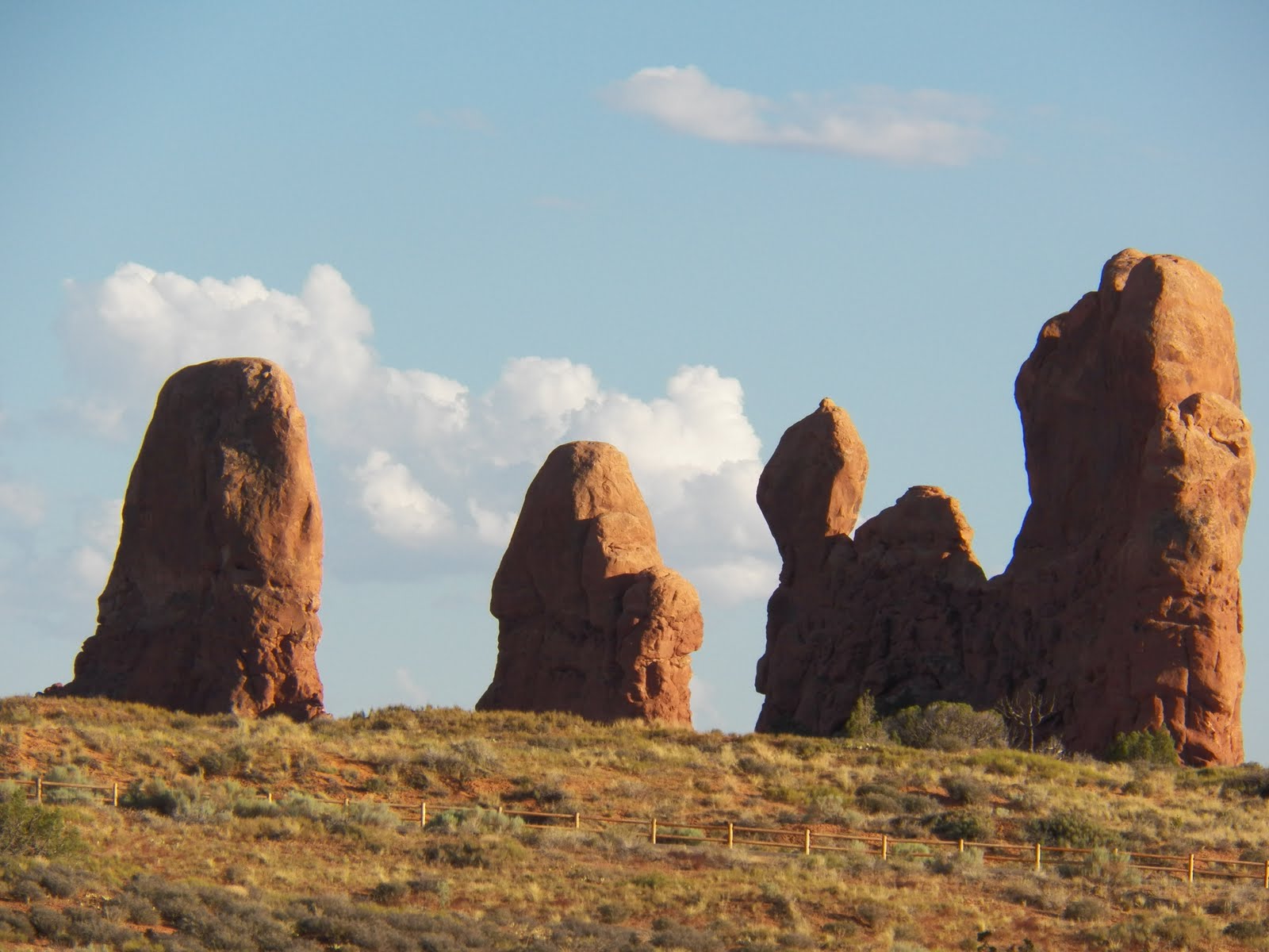
Park Avenue:


Balancing Rock:

Delicate Arch: A flash flood washed out the road to the Delicate Arch viewpoint just before I arrived in the park, stranding dozens of people until the waters receded late that night. A very helpful ranger told me where I could find an old-fashioned can-on-a-stick aimed at the arch. The shots aren't the best, but at least I was able to see. I also met a really nice British couple and was able to share the secret.


Double Arch: A short trail leads right up underneath the arches (some people were even climbing on them). The desert is surprisingly fragile; a biological soil crusts forms every where there aren't green plants. This crusts helps retain water and prevent erosion and is so fragile that it can take anywhere from 20 to 250 years for the crust to recover if it is crushed by a careless footfall. (Soapbox moment: It breaks my heart when I see people disregarding warning signs about environmental issues like this. It may seem fun at the time to venture off trail, but if everyone did it, soon the desert will be irrevocably altered).


Amazing well-preserved petroglyphs near the Delicate Arch trail head:

The Delicate Arch Trail: I didn't have enough water or a flashlight with me to attempt this, but it's definitely on my list for a return trip to Moab:

Fiery Furnace:

Skyline Arch:

Best. Sunset. Ever.

